OpenScan 3D Scans All Of The (Small) Things

The OpenScan project has been updated quite a bit since its inception. OpenScan is an open source, Arduino or Raspberry Pi-based 3D scanner for small objects that uses 3D printed hardware and some common electronic components to create 3D scans using photogrammetry; a process by which a series of still …read more

Continue reading OpenScan 3D Scans All Of The (Small) Things

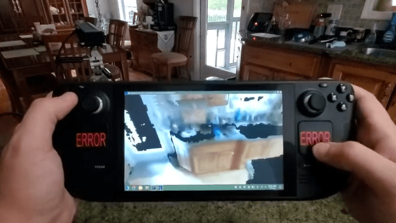
Handheld 3D Scanning, Using Raspberry Pi 4 and Intel RealSense Camera

When the Raspberry Pi 4 came out, [Frank Zhao] saw the potential to make a realtime 3D scanner that was completely handheld and self-contained. The device has an Intel RealSense D415 depth-sensing camera as the main sensor, which uses two IR cameras and an RGB camera along with the Raspberry …read more

Continue reading Handheld 3D Scanning, Using Raspberry Pi 4 and Intel RealSense Camera

Debunking Moon Landing Denial with an Arduino and Science

It’s sad that nearly half a century after the achievements of the Apollo program we’re still arguing with a certain subset of people who insist it never happened. Poring through the historical record looking for evidence that proves the missions couldn’t possibly have occurred has become a sad little cottage industry, and debunking the deniers is a distasteful but necessary ongoing effort.

One particularly desperate denier theory holds that fully spacesuited astronauts could never have exited the tiny hatch of the Lunar Excursion Module (LEM). [AstronomyLive] fought back at this tendentious claim in a clever way — with a DIY …read more

Continue reading Debunking Moon Landing Denial with an Arduino and Science

Make Use of Your Drone Video with WebODM

If you ever watch the original Star Trek, Captain Kirk and crew spend a lot of time mapping new parts of the galaxy. In fact, at least one episode centered on them taking images of some new part of space. It might not be new, but if you have a drone, you probably have accumulated a lot of frames of aerial imagery from around your house (or wherever you fly).

WebODM allows you to create georeferenced maps, point clouds and textured 3D models from your drone footage. The software is really an integration and workflow manager for Open Drone Map, …read more

Continue reading Make Use of Your Drone Video with WebODM